“MACHINE LEARNING FOR REMOTE SENSING AND MODELLING OF MOUNTAIN SNOW PATCHES”
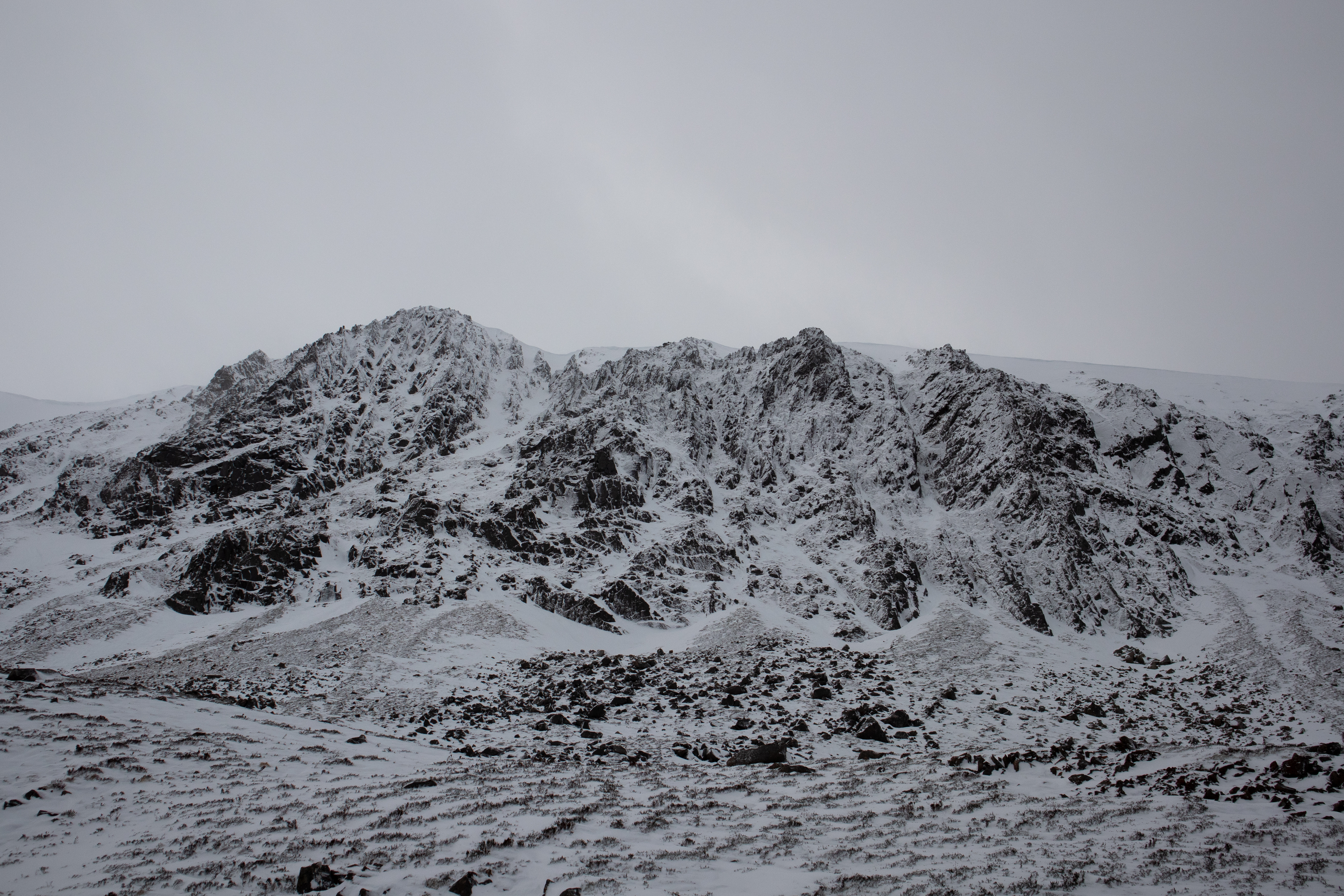
It might come as a surprise, but even in the mild climate of Scotland, snow manages to endure year-round in certain sheltered mountain locations. In fact, until recently, some highland corries would house perennial snow patches for many decades without seeing them melt. The fine balance between preferential snow deposition in winter and sheltering in summer makes predicting the distribution of these snow patches a rigorous test for the kind of physically based snow models used in climate projection and impacts studies. This is the basis of my PhD research.
Scientific Background and Motivation
Anthropogenic climate change is causing the mountain cryosphere (snow, ice, and permafrost) to deteriorate rapidly — a trend expected to accelerate over coming decades. The impacts will extend far beyond the mountains to affect physical, biological, and human systems in surrounding lowlands and oceans.
Mountain snow provides many services as a water store, habitat, and playground, but also poses risks (floods, avalanches) due to its high climate sensitivity.
The high spatial variability of snow in mountains makes it difficult to monitor and forecast using coarse-resolution satellite sensors and models — even though these environments need such forecasts most.
Even in Scotland’s maritime climate, snow can persist all summer in sheltered mountain spots. Some corries hosted perennial snow patches for decades until recently. Predicting the fate of these patches is a good test for physically-based snow models used in climate studies.
This project leverages new high-resolution remote sensing and meteorological modelling to better understand the climate sensitivity of mountain snow.
Aims and Objectives
Machine learning will be applied to three main challenges:
- Remote sensing of mountain snow cover in Scotland
- Downscaling meteorological variables over mountain topography
- Constraining physical snow models using remote sensing and meteorological data
Methodology
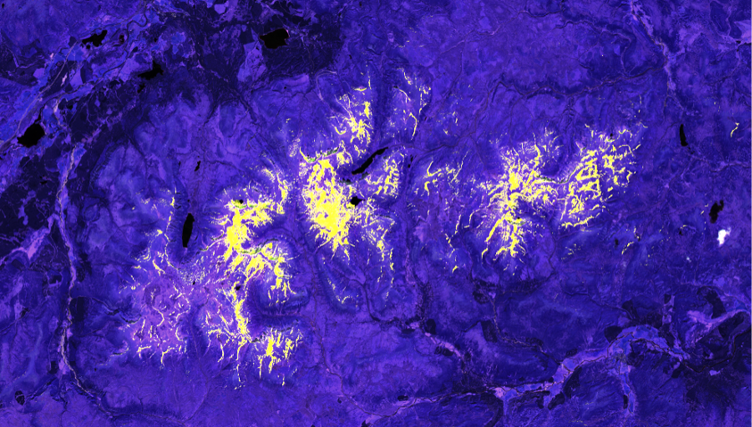
Step 1. Remote sensing of snow cover is most often achieved using differences between visible and near-infrared channels to distinguish snow from cloud, normalized to compensate for variations in illumination and viewing conditions, and thresholded to distinguish snow from snow-free ground. However, multispectral imagers and snow reflectance models actually provide much more information on snow structure and contaminants that can be exploited with machine learning. Training sets will be developed and used to train ANNs to discriminate snow specifically for snow conditions occurring in the Cairngorms. Initially, I am focusing on using optical imagery from starting from ESA’s Sentinel-2 satellite.
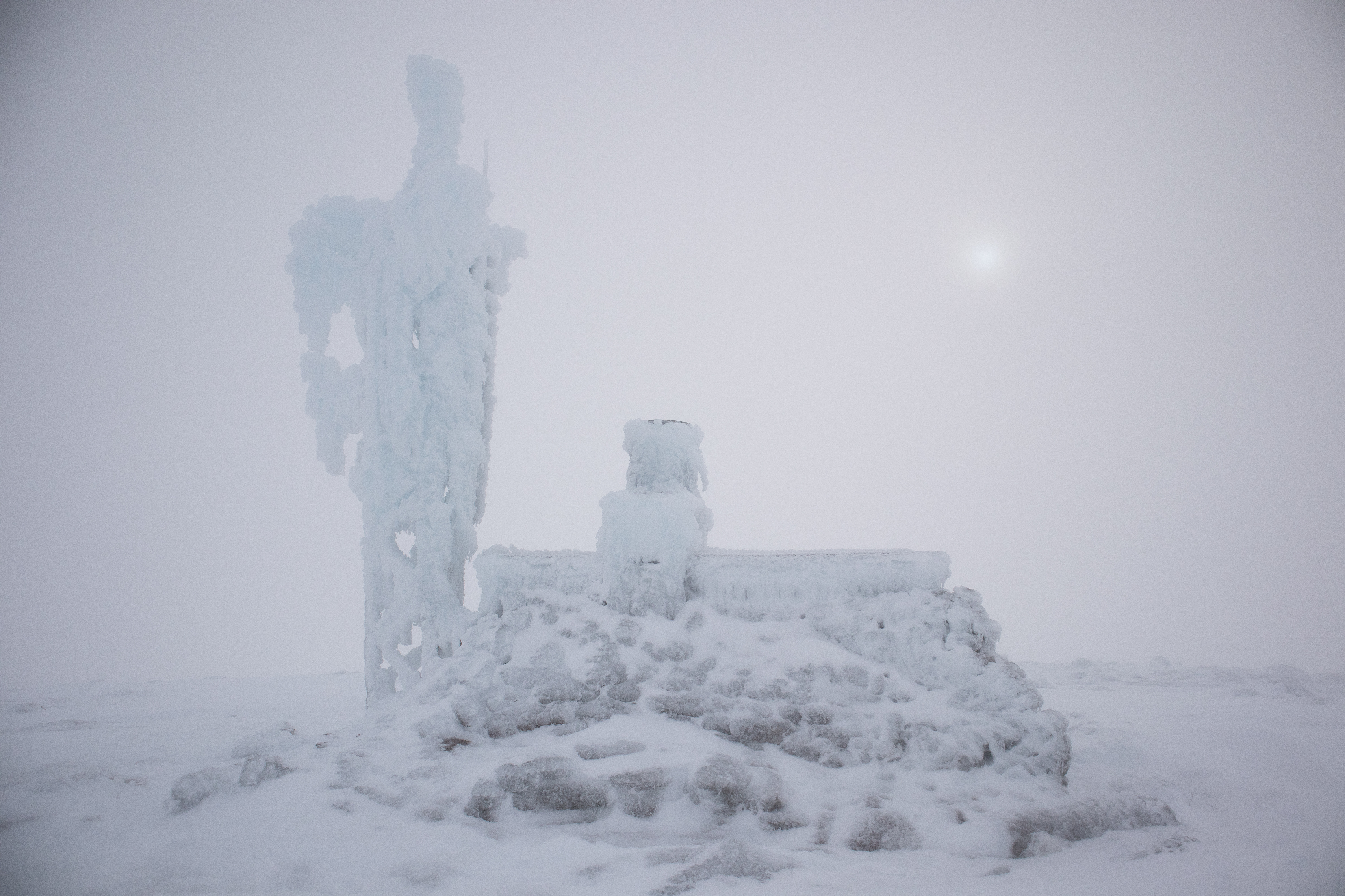
Step 2. Weather stations that could provide inputs for snow models are sparse and difficult to maintain in the mountains (epitomized in the above image). Numerical Weather Prediction (NWP) at 1 km resolution and Computational Fluid Dynamics (CFD) models at higher resolutions are now available but limited in spatial and temporal coverage. Hydrological forecasting and impacts models generally use simple elevation lapse rates to downscale meteorological variables, but some variables – precipitation and wind, in particular – clearly do not behave in such simple ways. Machine learning will be used to identify patterns in NWP and CFD model outputs that can be used for downscaling.
Step 3. A high-resolution, physically-based snow model will be driven with downscaled meteorology and evaluated with remote sensing products developed in this project. Some of the processes required in models of this type, such as shading of snow on slopes, are well understood but require expensive simulations at high resolutions. Other processes, such as wind erosion, turbulent transport and re-deposition of snow, are poorly understood and heavily parametrized. Physical constraints of mass and energy conservation will be incorporated into machine learning of snow patterns, using meteorological variables and topographic metrics as inputs to gain insight into the relative importance of factors contributing to the preservation of late-lying snow patches.
Fieldwork for this project will be focused close to home enabling a fast response to favourable weather conditions and limiting our carbon footprint. There will be a heavy focus on the Cairngorms, take advantage of connections with existing hydrometeorological measurements in the Feshie and Coire Cas catchments of the Cairngorms.