SPUN (a Snow Patch U-Net)
This pages is a home for visualisations and dashboards generated using the SPUN (Snow Patch U-Net) deep learning model for mapping snow cover from Sentinel-2 imagery. SPUN was designed for mapping snowpatches in the Scottish Highlands (as part of my PhD research studying these small decametre-scale features) but shows promise for wider applications in snow mapping and monitoring.
You can read more details about the SPUN model in our preprint: https://egusphere.copernicus.org/preprints/2026/egusphere-2026-3163/
Tracking snowpatches in the Scottish Highlands
SPUN was primarily intended as a tool for tracking late-lying snowpatches in the Scottish Highlands as part of my PhD research. Here we present the melt-season snowmaps derived using SPUN and zoomed in on iconic snowpatch locations:
- The Sphinx snowpatch, Braeriach
- Ciste Mhearad (Margaret’s Coffin) snowpatch, Cairn Gorm Mountain
- Aonach Beag snowpatch, coming soon…
- Ben Nevis, coming soon…
Cairngorms snow cover
The Cairngorms National Park is the snowiest region in the UK — a unique subarctic-alpine landscape characterised by its high plateaus, rugged terrain and diverse ecosystems, making it an ideal location for studying snow dynamics in a mountainous environment. Here we present a dashboard of SPUN snow maps for the whole national park spanning 2016-2026:
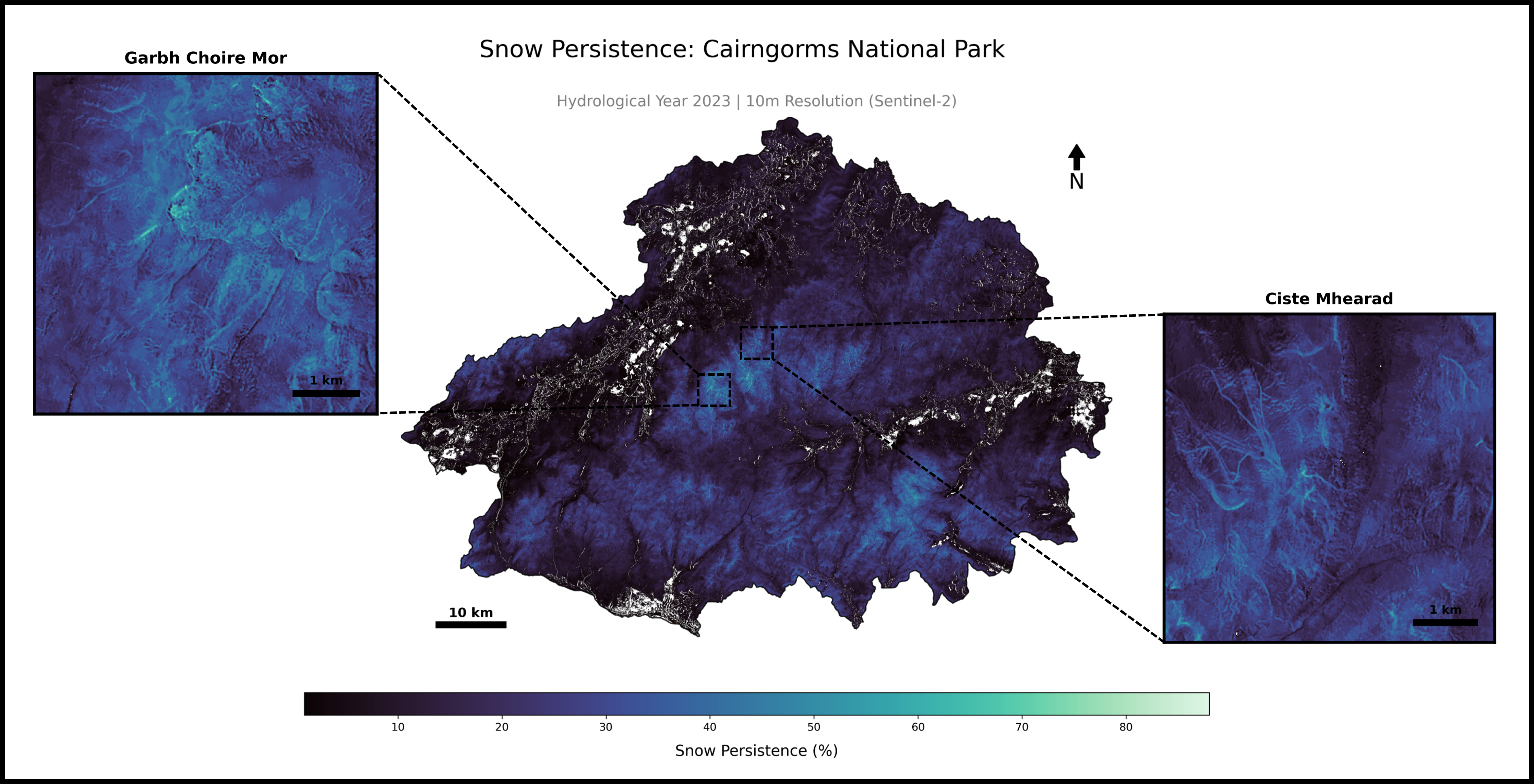
We have used these snowmaps to derive annual and Sentinel-2 wide snow persistence maps for the Cairngorms at 10 m resolution (higher than ever before):
Please get in touch if you have any questions or feedback: leamhowe1@gmail.com